Aerial Alaska
Experiencing Alaska from the air is the ideal way to feel dwarfed by the sheer expanse of this State. By bush plane, you can feel like a "mosquito" flying next to walls of mountain thousands of feet tall … or, on a clear day, enjoy the ultimate scenic flight in a jet at 35,000 feet. Either way, it is an experience that lasts a lifetime. The ultimate "Birds-Eye View!"
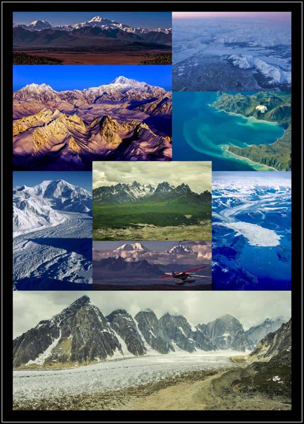
Top: Mt. Hunter and Denali rise above the contrasting autumn colors blanketing the delta at the southern edge of Denali National Park and Denali State Park.
The wild eastern outflow of the Copper and Martin Rivers of the Copper River Delta State Critical Habitat area with the Chugach and Ragged Mountains in the foreground from 32,000 feet.
Second Row: Winter's February sunrise on Mt. Hunter and Denali of the central Alaska Range with golden light on the jagged Tokosha Mountains in the foreground; viewed from 13,000 feet.
Kodiak Island, the second largest island in the United States and 80th in the world, shows off its rugged coastline along the Gulf of Alaska at Dangerous Cape and Boulder Bay. Tidal forces and wave action are visible in this view from 35,000 feet.
Third Row: Mt. Foraker rises 17,400 feet above a snow-white winter scene looking northward up the Lacuna Glacier; viewed from about 10,000 feet.
Center-top: The grand spires of the Tokosha Mountains stand in stark contrast to the green foothills and the terminal moraine debris of the Ruth Glacier.
Center-bottom: Mt. Foraker and Mt. Hunter are "islands in the clouds" in this view from above Curry Ridge in the Talkeetna Mountains and Denali State Park.
Far right: A stunning view of the terminus and calving ice off massive Columbia Glacier with many of its associated branches filling the Chugach Mountains in northern Prince William Sound; viewed from 35,000 feet.
Panorama: The impressive 5,000-foot granite monuments of the west-central Ruth Glacier stand like sentinels above Ruth Gorge in the southern Alaska Range within Denali National Park and Preserve.
In height, the top of the cliffs to the bottom of Ruth Glacier surpasses the depth of the Grand Canyon. Ruth Glacier was moving about three feet a day in 1983 when it measured 4,000 feet thick. It has receded much since that time.
All images © Dave Parkhurst www.TheAlaskaCollection.com


